Kujawsko-Pomorska Digital Library contains 262 784 digital objects
Object
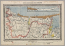
Title: Kreis Danziger Niederung
Description:
Skala 1:100 000 ; Tyt. z mapy ; 1 mapa : kolor. ; 26x44 cm, na ark. 36x52 cm ; Kolorami oznaczone obszary dóbr królewskich (lasy, majątki ziemskie, kolonie, osady), wody i granice powiatów.
Contributor:
Geographischen Institut Paul Baron ; Oskar Eulitz Verlag
Publisher:
Place of publication:
Format:
Original identifier:
Language:
Digital object identifier:
Rights:
Domena publiczna (Public domain)
Access Rights:
Resource Identifier:
Digitalisation:
Biblioteka Uniwersytecka w Toruniu
Original in:
Biblioteka Uniwersytecka w Toruniu
Sponsor:
Ministerstwo Nauki i Szkolnictwa Wyższego, grant nr 884/P-DUN/2013/2014
Object collections:
- Kujawsko-Pomorska Digital Library > Cultural heritage > Maps
- Kujawsko-Pomorska Digital Library > Regional materials > Cuiaviana, Pomeranica > Maps
Last modified:
Nov 15, 2023
In our library since:
Aug 7, 2014
Number of object content hits:
560
Number of object content views in DjVu format
587
All available object's versions:
https://kpbc.umk.pl/publication/78641
Show description in RDF format:
Show description in OAI-PMH format:
| Edition name | Date |
|---|---|
| Kreis Danziger Niederung | Nov 15, 2023 |
Objects Similar
Geographischen Institut Paul Baron Oskar Eulitz Verlag
Verlag von A. W. Kafemann H. F. Jütte Kunstanstalt


