Kujawsko-Pomorska Digital Library contains 263 806 digital objects
Object
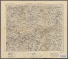
Title: Kolki R 37 ; R 37. Kolki
Description:
Vorlaufige Ausgabe ; Skala 1:100 000 ; 1 mapa ; 30x37 cm, na arkuszu 36x42 cm ; Tytuł znad ramki ; Rzeźba terenu przedstawiona metodą kreskową ; Na dolnym marginesie dwie podziałki liniowe wyrażone w metrach i wiorstach, krokach i milach geograficznych ; Południk zerowy Ferro ; Pod dolną ramką: Photolithogr. Vergrösserung der Special Karte v. Mittel-Europa (Reymann) ; Na odwrocie arkusza: Rußlands 1:100 000 Gruppe IV Sektion R 37. Kolki
Contributor:
Prusy. Königliche Preussische Landesaufnahme Kartographische Abteilung
Publisher:
[Kartographische Abteilung d. Königl. Preuss. Landes-Aufnahme]
Place of publication:
Format:
Original identifier:
Language:
Relation:
Karte des westlichen Rußlands 1:100 000
Digital object identifier:
Rights:
Domena publiczna (Public domain)
Access Rights:
Resource Identifier:
Digitalisation:
Biblioteka Uniwersytecka w Toruniu
Original in:
Biblioteka Uniwersytecka w Toruniu
Sponsor:
Ministerstwo Nauki i Szkolnictwa Wyższego (umowa nr 590/P-DUN/2018)
Object collections:
Last modified:
Nov 15, 2023
In our library since:
Oct 16, 2018
Number of object content hits:
25
Number of object content views in Galeria format
35
All available object's versions:
https://kpbc.umk.pl/publication/198238
Show description in RDF format:
Show description in OAI-PMH format:
| Edition name | Date |
|---|---|
| Kolki R 37 | Nov 15, 2023 |


