Kujawsko-Pomorska Digital Library contains 262 940 digital objects
Object
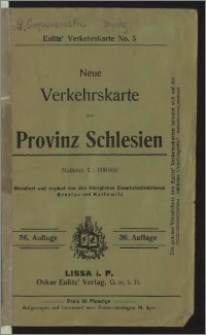
Title: Neue Verkehrskarte der Provinz Schlesien
Description:
1 mapa : litogr. kolor. ; 38x60 cm, na ark. 44x64 cm, całość w okł. 19x13 cm. ; Maassstab 1:600 000. ; Nad ramką mapy: Neueste Ausgabe, revidirt von den zuständigen Behörden. ; W lewym dolnym rogu pod ramką mapy: Aus Dr. W. Koch u. C. Opitz, Eisenb. u. Verkehrs-Atlas. ; W prawym dolnym rogu pod dolną ramką mapy: J. J. Arnd, Geogr. Anstalt, Leipzig. ; Mapy poboczne: Oberschlesisches Kohlen - und Industriegebiet, 1:200 000, 13x19 cm; Breslau, 1:100 000, 9x12 cm; Westliche Fortsetzung, 5x9 cm. ; 36. Aufl. ; Eulitz' Verkehrskarte. No. 5
Contributor:
Publisher:
Place of publication:
Format:
Source:
Language:
Relation:
Rights:
Domena publiczna (Public domain)
Access Rights:
Resource Identifier:
Digitalisation:
Wojewódzka i Miejska Biblioteka Publiczna w Bydgoszczy
Original in:
Wojewódzka i Miejska Biblioteka Publiczna w Bydgoszczy
Sponsor:
Projekt e-Kultura WZP.273.55.2014
Object collections:
- Kujawsko-Pomorska Digital Library > Cultural heritage > Maps
- Kujawsko-Pomorska Digital Library > Recommended
- Kujawsko-Pomorska Digital Library > Collections of project partners > Voivodeship and Municipal Public Library of Dr. Witold Bełza in Bydgoszcz
Last modified:
Nov 15, 2023
In our library since:
Nov 14, 2016
Number of object content hits:
135
Number of object content views in DjVu format
135
All available object's versions:
https://kpbc.umk.pl/publication/166263
Show description in RDF format:
Show description in OAI-PMH format:
| Edition name | Date |
|---|---|
| Neue Verkehrskarte der Provinz Schlesien | Nov 15, 2023 |
Objects Similar
Wojskowy Instytut Geograficzny
Instytut Kartograficzny i Wydawniczy "Glob" J. Chodorowicza
Gotz, Marceli Walkiewicz, Władysław


