Kujavisch-Pommersche Digitale Bibliothek contains 262 784 digital objects
Object
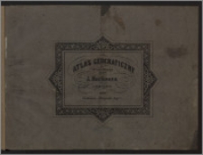
Title: Atlas geograficzny złożony z 20 mapp
Beschreibung:
1 atlas (20 k.) : litogr., mapy kolor. ; 46x35 cm. ; Skale różne. ; Rzeźba terenu przedst. metodą kreskową. ; Na niektórych mapach: lit. R. Baumann. ; Granice ręcznie kolorowane.
Herausgeber:
nakładem Litografii J. Herknera
Verlagsort:
Format:
Quelle:
Sprache:
Rechte:
Domena publiczna (Public domain)
Zugriffsrechte:
Identifikation des Bestandes:
Digitalisierung:
Wojewódzka i Miejska Biblioteka Publiczna w Bydgoszczy
Besitzen:
Wojewódzka i Miejska Biblioteka Publiczna w Bydgoszczy
Sponsor:
Projekt e-Kultura WZP.273.55.2014
Object collections:
- Kujawsko-Pomorska Digitale Bibliothek > Kulturelles Erbe > Karten
- Kujawsko-Pomorska Digitale Bibliothek > Didaktische und wissenschaftliche Schriften > Geografie
- Kujawsko-Pomorska Digitale Bibliothek > Empfohlen
- Kujawsko-Pomorska Digitale Bibliothek > Sammlungen von Projektpartnern > Woiwodschafts- und Stadtbibliothek von Dr. Witold Bełza in Bydgoszcz
Last modified:
15.11.2023
In our library since:
07.07.2016
Number of object content hits:
191
Number of object content views in DjVu format
197
All available object's versions:
https://kpbc.umk.pl/publication/159125
Show description in RDF format:
Show description in OAI-PMH format:
| Edition name | Date |
|---|---|
| Atlas geograficzny złożony z 20 mapp | 15.11.2023 |
Objects Similar
Gaspari, Adam Christian (1752-1830) Güssefeld, Franz Ludwig (1744-1808) Geographisches Institut (Weimar)
J.-C.-Hinrichs'sche Buchhandlung (Lipsk)
J.-C.-Hinrichs'sche Buchhandlung (Lipsk)
Sohr, Karl Berghaus, Heinrich Karl Wilhelm (1797-1884) Carl Flemming und C. T. Wiskott Aktiengesellschaft für Verlag und Kunstdruck (Głogów)
Mercator, Gerard (1512-1594)
Bonne, Rigobert (1727-1795)
Cohrs, Edvard (1858-1934) Rönnholm, Nils Generalstabens litografiska anstalt


