Kujawsko-Pomorska Digital Library contains 263 840 digital objects
Object
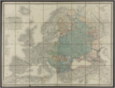
Title: Carte de L''Europe avec L'Indication de la Situation des Races Slaves
Description:
1 mapa : kolor., miedzioryt, podklejona na płótnie. ; 98 x 132 cm. ; Skala nie podana. ; Na mapie umieszczono tabelę statystyczną różnych ras Słowian zamieszkujących Europę. Kolorami zaznaczono narody zamieszkujące kraje Europy centralnej, południowej i wschodniej.
Publisher:
Place of publication:
Format:
Source:
Language:
Rights:
Domena publiczna (Public domain)
Access Rights:
Resource Identifier:
Digitalisation:
Wojewódzka i Miejska Biblioteka Publiczna w Bydgoszczy
Original in:
Wojewódzka i Miejska Biblioteka Publiczna w Bydgoszczy
Sponsor:
Projekt e-Kultura WZP.273.55.2014
Object collections:
- Kujawsko-Pomorska Digital Library > Cultural heritage > Maps
- Kujawsko-Pomorska Digital Library > Recommended
- Kujawsko-Pomorska Digital Library > Collections of project partners > Voivodeship and Municipal Public Library of Dr. Witold Bełza in Bydgoszcz
Last modified:
Nov 15, 2023
In our library since:
May 13, 2016
Number of object content hits:
69
Number of object content views in DjVu format
66
All available object's versions:
https://kpbc.umk.pl/publication/156119
Show description in RDF format:
Show description in OAI-PMH format:
| Edition name | Date |
|---|---|
| Carte de L''Europe avec L'Indication de la Situation des Races Slaves | Nov 15, 2023 |
Objects Similar
Klante, Margarete. Oprac. Verlagsanstalt Otto Stollberg (Berlin) Niemcy. Reichsamt für Landesaufnahme
Mahlmann, Heinrich (1830-1873) Friedrich Heinrich Morin (Berlin)
Sotzmann, Daniel Fridrich (1754-1840)
Hermann, M. Verlag von Carl Flemming (Głogów)
Handtke, Friedrich H. (1815-1879) Verlag von Carl Flemming (Głogów)
nach den besten Hülfsmitteln bearbeitet
Wiercieński, Henryk (1843-1923) Jarzyński, Adam


