Kujawsko-Pomorska Digital Library contains 263 745 digital objects
Object
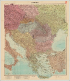
Title: Velhagen & Klasings Karte : Der Balkan
Description:
1 mapa : kolor. ; 96x84 cm, na ark. 107x83 cm, złoż. 27x19 cm ; Skala 1:2 000 000 ; Tyt. z mapy ; Rzeźba terenu: metoda kreskowa, barwy batymetryczne, punkty głębokości i wysokości
Contributor:
Publisher:
Place of publication:
Format:
Original identifier:
Language:
Digital object identifier:
Rights:
Domena publiczna (Public domain)
Access Rights:
Resource Identifier:
Digitalisation:
Original in:
Wojewódzka Biblioteka Publiczna - Książnica Kopernikańska w Toruniu
Sponsor:
Projekt e-Kultura WZP.272.42.2014
Object collections:
- Kujawsko-Pomorska Digital Library > Cultural heritage > Maps
- Kujawsko-Pomorska Digital Library > Collections of project partners > Voivodeship Public Library - Copernicus Library in Toruń
Last modified:
Nov 15, 2023
In our library since:
Jan 29, 2016
Number of object content hits:
89
Number of object content views in DjVu format
87
All available object's versions:
https://kpbc.umk.pl/publication/147409
Show description in RDF format:
Show description in OAI-PMH format:
| Edition name | Date |
|---|---|
| Velhagen & Klasings Karte : Der Balkan | Nov 15, 2023 |
Objects Similar
Wit, Friderick de
Tresić-Pavičić, Ante (1867-1949)


